The Pinaleños are one beautiful and gnarly mountain range. We have a lot more exploring to do in this range, and it is guaranteed to be an adventure. Looking at a map, everything looks lovely. Like many trails in Arizona, constructed by the CCC and never given much maintenance beyond that, the trails are not in the greatest of shape. But to make it worse, several huge fires and floods have rendered parts of the landscape drastically altered, and parts of some trails are essentially gone.

The high point of the Pinaleños, Mount Graham, is the southernmost mountain in the US over 10,000 feet in elevation. But you can’t go to the summit. There is an endangered endemic squirrel in the Pinaleños, the Mount Graham Red Squirrel, that was nearly driven to extinction in the Frye Fire of 2017. The summit area is protected habitat for the squirrel as well as being home to an observatory, so access to the peak is restricted.
Two cool Brett Tucker routes intersect through the Pinaleños: the Grand Enchantment Trail (GET) and the Sky Islands Traverse (SkIT). We have attempted and failed at both of the original routes through here, though I think we’ve become a bit more hardened since the last time we were there and are ready for another beating.

With some time to explore, the Pinaleños offer some solid type 2 fun for those who like to get off the beaten path, do a little wayfinding, and thoroughly punish themselves. We should have known what we were in for right from the start the first time we came to Mount Graham. We asked some forest workers where the trail was and they had no idea.
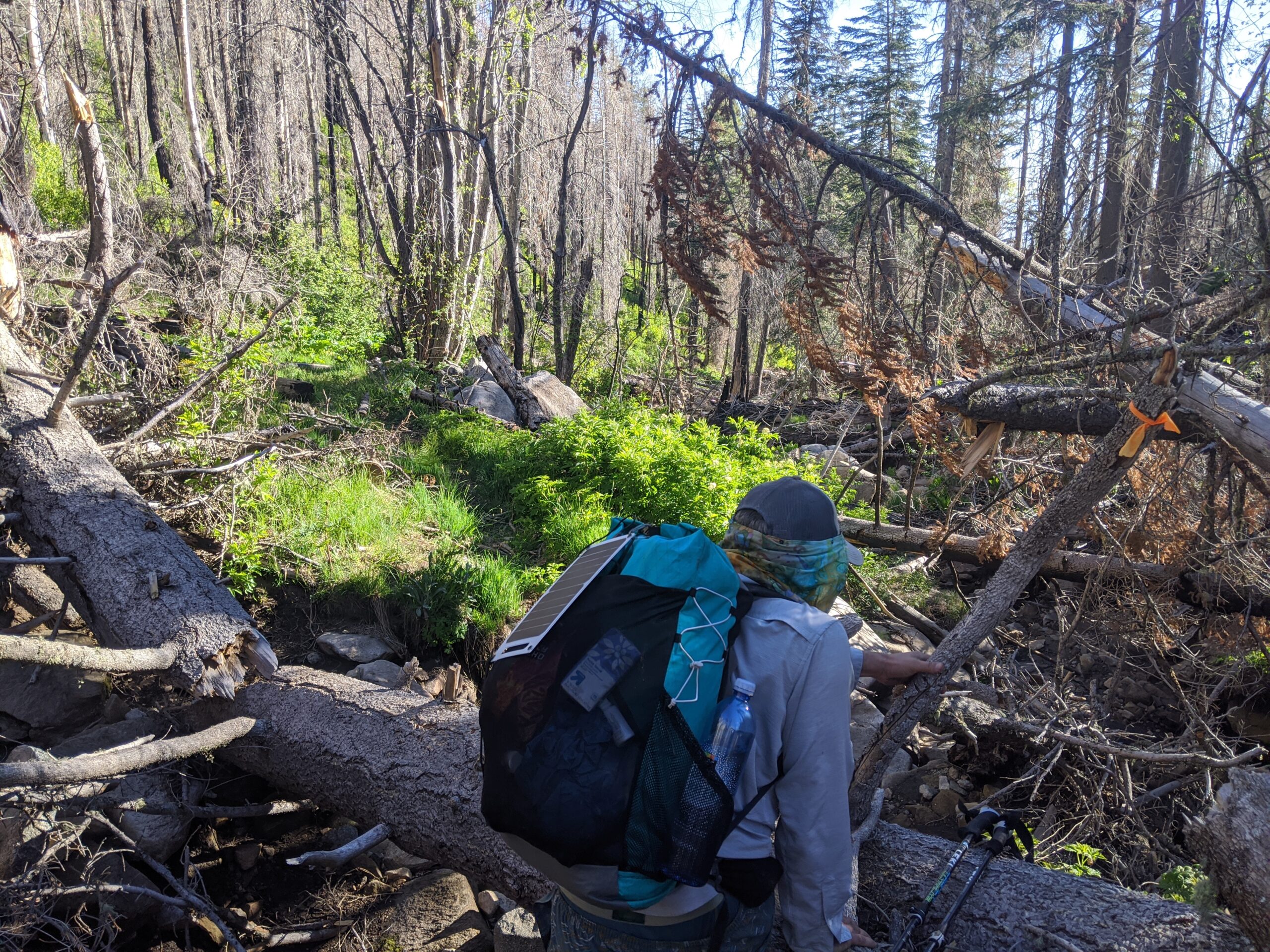
We were taking the trail from the top of the mountain, planning to head generally down and around Mount Graham. Off we went in the general direction and found a very faint trail. The aftermath of the burn three years earlier was bad, there was dead debris everywhere, and the thick underbrush that explodes in the wake of a very destructive fire.
We were supposed to be on the Round the Mountain Trail, part of the SkIT. We were able to follow the trail for a short while, losing it, finding it again, continuing on in the general direction the trail was supposed to be going. But the terrain got steeper, and eventually the trail had solidly vanished. The ground was steep and crumbly, with no vegetation holding in the rocks and soil. Anything that did grow was sharp. We moved uphill, we moved downhill, we followed faint game trails, but eventually it just did not feel safe to continue, and we returned in defeat.

Not ready to give up though, we made our way to Ash Canyon to follow the Ash Creek Trail, part of the GET. This canyon is apparently unrecognizable to what it was before. Old trip reports make it sound like a real oasis.
The first challenge was all the dead trees. Some of them were really big, so there was plenty of climbing involved. Then there were the stinging nettles. Being in shorts, I stepped in it a few times. There was a general lack of trail, but following a stream makes for easy navigation. But there were still large boulders to negotiate, steep terrain, and sharp overgrown plants. I’m not sure if we enjoyed ourselves in the moment, but as soon as we left, we started talking about going back, exploring more.

This time we attacked Frye Canyon from below. I knew that Frye canyon eventually intersected with the Round the Mountain Trail, at a point farther than we had made it, so maybe we could evaluate the conditions and try and find a route heading back to where we had made it before. But Frye Canyon was a beast.
There remained a faint trail for the most part, but it disappeared often. There were cat claw thickets and other dense, prickly plants everywhere. The going was slow and sometimes frustrating. Finally, we made it to the sign marking the intersection with the Round the Mountain Trail. We looked uphill, we looked downhill. No trail. Surely there are remnants of it somewhere on the backside of this mountain, but it seems that the flooding has washed most of it out.

We still have one more attempt to make along the SkIT, and that is to attack the Round the Mountain Trail itself from the base of the mountain. I know from recent trip reports that at least the first few miles are in decent shape. Beyond that, I am curious to know just how far you can get on this trail from the opposite side.
Similarly, I’d like to return to the GET in Ash Canyon and make the entire descent, as we really only went about a third of the way down, reportedly the roughest section. Because these trails are so remote, I’m not sure there’s much hope for any restoration, but the canyons still seem to get some usage, so hopefully some efforts will go to trail work in those areas. For now though, the trails are basically gone.
Interesting blog post