Southern Arizona is home to a unique ecosystem. Lowlands punctuated by mountain ranges, coupled with biannual rainy seasons, has made the Sonoran Desert the most biodiverse desert on the globe.

Thousands of years ago, when the climate was wetter and cooler, the lowlands were made up of pinon-juniper-oak forests. Over time, the climate changed and the lowland forests gave way to desert. Cacti, creosote, agave, and other arid plants dominate the lowlands. Meanwhile, the mountain ranges still give way to mixed conifer forests. The species living at the higher elevations, once linked to each other via the lowland forests, became isolated from one another, the species in each distinct range unable to cross the sea of desert that separated them from the neighboring mountains.
These are the Madrean Sky Islands – 55 unique and isolated high-elevation forests dotting the landscape of Mexico, Southern Arizona and Southwestern New Mexico. Each Sky Island is home to a unique habitat with its own endemic species – plants and animals that have evolved in isolation with their home range and are not found anywhere else on earth. Many of these species are now threatened or endangered. These ranges also provide habitat for a wide variety of birds, oftentimes at the northern reaches of their ranges, making Southern Arizona home to a large variety of birds typically found in Mexico or Central America and nowhere else in the US.

Many of the ranges in Southern Arizona are Sky Islands: The Rincons, Catalinas, Santa Ritas, Pinalenos, Dragoons, Chiricahuas, Huachucas, and more. Traveling from the base to the peaks of one of these mountains, you’ll travel through 5 distinct biomes: desert, grassland, chaparral, deciduous forest, to coniferous forest. These mountains make fantastic cooler-weather getaways for desert-dwellers. (The small community atop the Catalinas is aptly named Summerhaven). Even in the winter months, we can leave the cactus behind to play in the snowy forest simply by heading into one of these ranges.
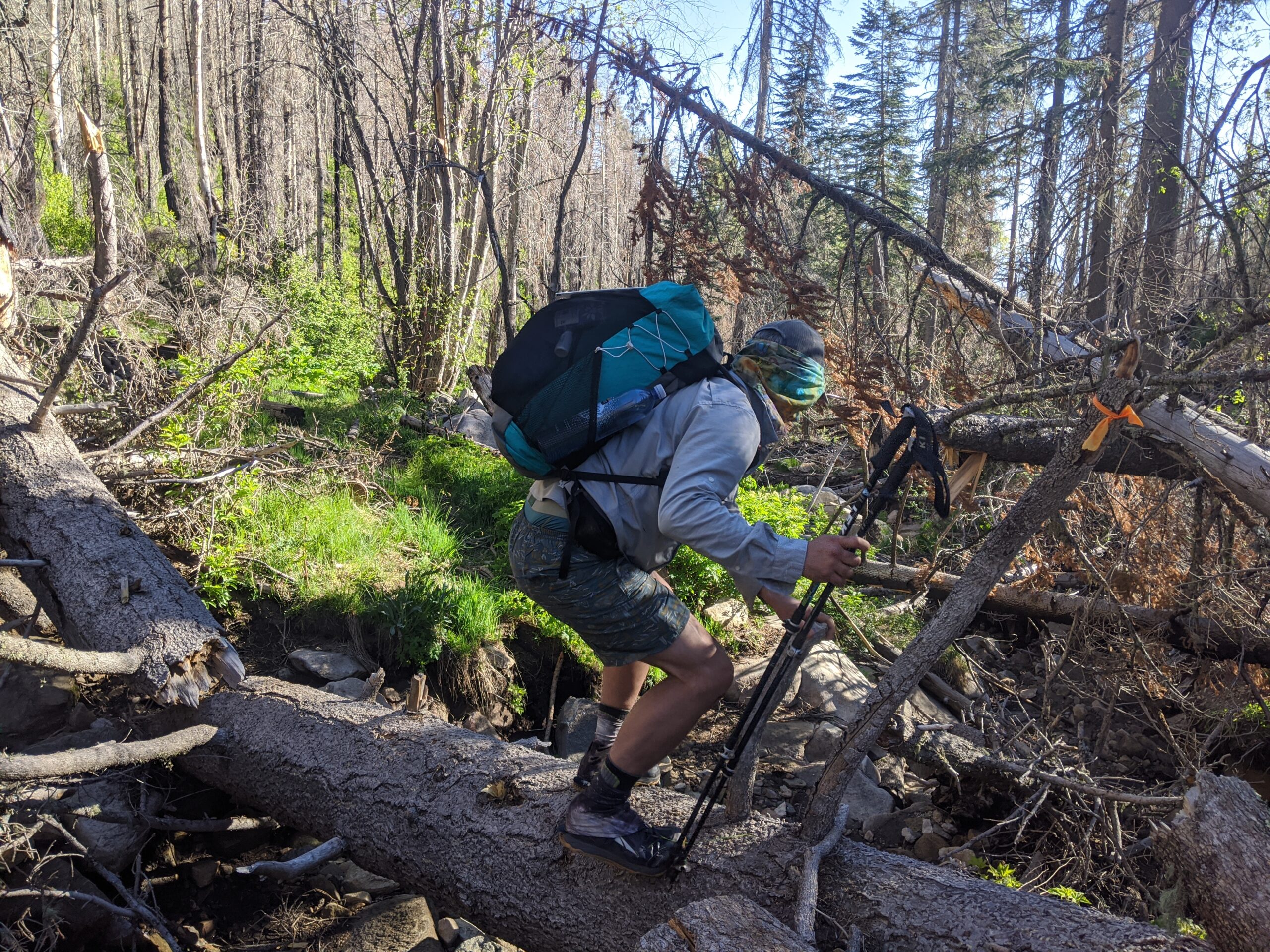
Several years ago Paul and I set out to hike the Sky Islands Traverse (SkIT for short), a thru-hike route developed in 2010 by Brett Tucker. Tucker is most well-known for the Lowest to Highest Route, but he has made a handful of routes in the desert southwest known for their ruggedness. Very few people have completed the SkIT, and for good reason. Much of it is off-trail, some of it skirts private land, and some segments are particularly rugged. Fire has ravaged the mountains, particularly in 2011 but also in 2016, 2017 and 2020. In the Chiricahuas and Pinalenos specifically, the fires and subsequent flooding completely wiped some trails off the map. Travel through these mountains is oftentimes frustrating and sometimes hazardous, but always adventurous.

Having made our attempt in October, Paul and I found ourselves hiking in unseasonably hot and dry conditions. After a week of temperatures over 100 degrees, we decided we were not enjoying the adventure and decided to head to Colorado for some cooler weather. But, we still have a fondness for this route and especially for the unique ranges we’ve only begun to explore. The SkIT crosses 10 Sky Island Ranges, and we’ve explored 7 of them. I will post a write-up of each range, our highlights as well as our tribulations in each. As we explore new ranges I will write about those as well. I’ll start with the Chiricahuas.
More Sky Islands:
Pinaleños
Santa Ritas
Rincons
Dragoons
Bikepacking the Santa Ritas
8 thoughts on “Adventures in the Fire-Ravaged Sky Islands”