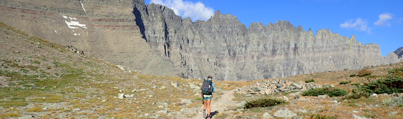
Hello Friends, it’s been awhile. We’ve been working a lot lately. But the time has come for a new adventure. At the beginning of July, we are flying up to Deadhorse, Alaska, and riding our bikes home to Tucson, Arizona. It will be a journey of 6,000+ miles, and we expect it will take around six months.
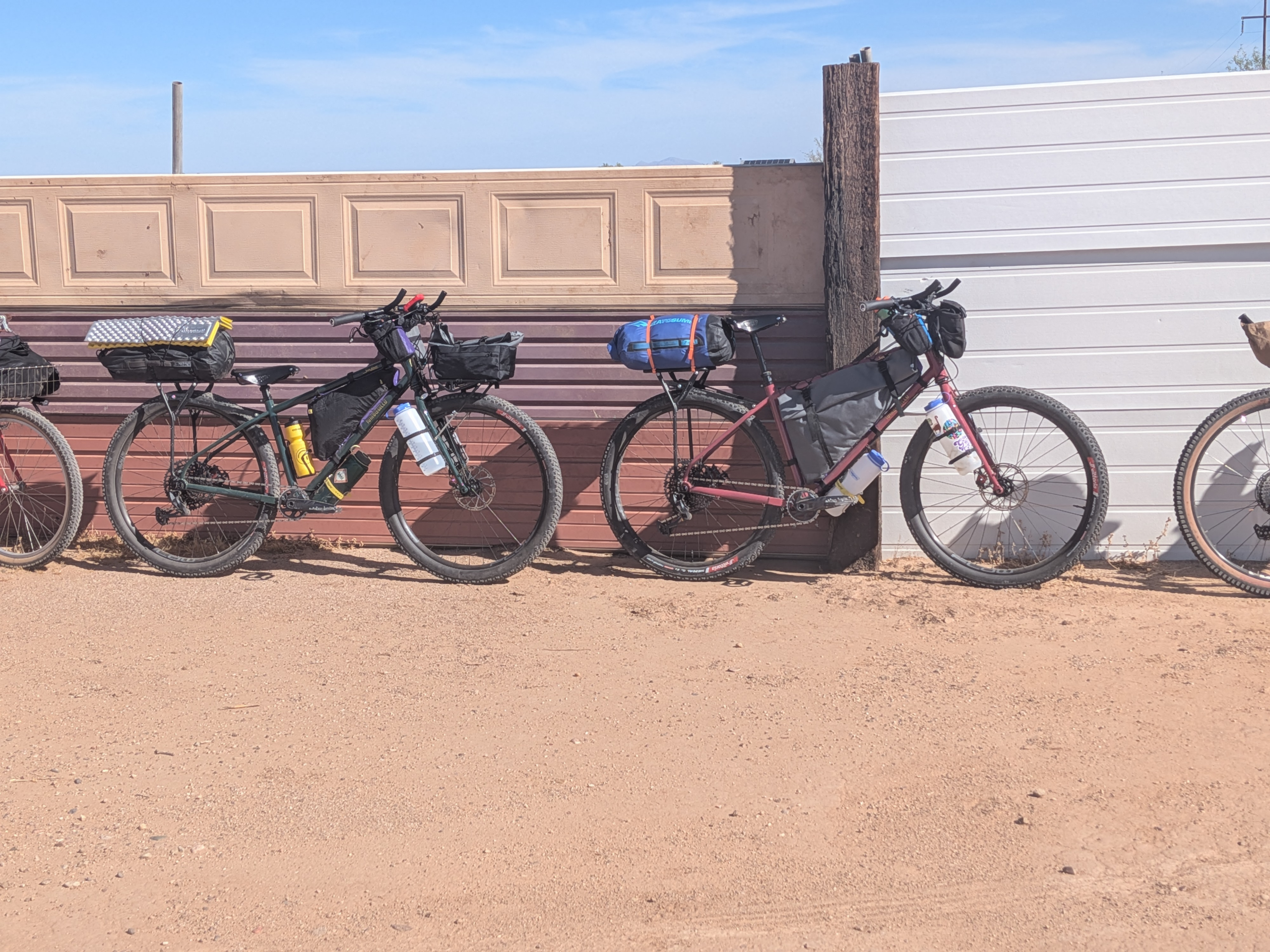
For the past few months, we’ve been making preparations. We’ve built new bikes, we’ve made bike bags, we’ve bought some new gear, we’ve done a lot of research and watched a lot of YouTubes. I’ll be posting our gear lists and bag details in the coming weeks before we hit the road. Are we the BikingHammonds now?
Why This Trip?
So many reasons! I’ve always kinda wanted to do a cross-country cycling trip, but for many years Paul was less interested in cycling than I was. But about 2 years ago, he got a mountain bike, and fell in love with bikepacking. We knew we wanted to do a long-distance bike trip, but for a long time we weren’t sure exactly where or when.

I’d been watching videos of different biking routes, and somehow stumbled upon Alaska’s Dalton Highway. Originally called the Haul Road, the highway was constructed in the 1970s to service the Trans-Alaska Pipeline and improve access to the oil field at Prudhoe Bay. The road has been open to the public since 1994 but is still mainly utilized by trucks coming and going from the oil fields. The road is challenging, with steep grades, gravel and mud. Adventurers come to tackle this road in their vehicles, on their motorcycles, or on their bicycles during the Arctic summer.
I learned that many people ride the Dalton Highway as the beginning of a journey from the top of Alaska to the bottom of Argentina, riding the length of the Americas on a cycling journey of two years or more. That is a bit too long for us, but it planted the seed to complete a section of that journey, and ride our bikes from Alaska back home to Arizona.
The Route
A trip like this is not laid out. The route possibilities are endless – figuring out the route can feel overwhelming at times. Fortunately, the first couple thousand miles are pretty straightforward, because there aren’t that many roads to choose from. We start on the Dalton Highway and follow it all the way to the end, for 414 miles. From there it’s 85 miles to Fairbanks on the Elliott Highway. Fairbanks is our first major resupply and our first real junction.

We could head southeast out of Fairbanks toward Tok, but we’d rather head southwest to take the long route and visit Denali National Park and ride the scenic Denali Highway before getting to Tok.

Tok is our second junction. From there, we could head down the Alaska Highway to Whitehorse, Yukon, or we could take the Top of the World Highway through Dawson City and into Whitehorse. We are planning on Top of the World Highway, but if we are feeling crunched for time then we can take the Alaska Highway instead. After Whitehorse, we’ll follow the Alaska Highway to Watson Lake.

Leaving Watson Lake and heading into British Columbia, there are suddenly a lot more route options. We have to decide: Do we want to see Jasper and Banff on this journey, or do we want to come down closer to the coast and Vancouver? After much back and forth we decided we’d like to incorporate Vancouver Island into the journey. This also gives us the opportunity to incorporate a segment of the inside passage via ferry ride. And visit family on Whidbey Island.
So leaving Watson Lake, we will head south along the Cassiar Highway, including a stop to see the Salmon Glacier before heading to Prince Rupert and taking the ferry to Vancouver Island.

If we have time, we will also include a side trip to the island of Haida Gwaii. As you can see from my map, of Vancouver Island, there are a lot of route options mapped out, but we haven’t decided exactly which route we will be taking just yet.

Once we cross back into the United States, the options get even more endless. I’ve mapped out a lot of potential routes, but this part of the journey is so far out that I know better than to plan it too closely. Nothing goes to plan on trips like this. Weather can change things. Fire can change things. A million other unforeseen circumstances can change things. We’ll figure these decisions out when the time comes. This is what my map looks like right now:

All cleaned up, the route I think we are most likely going to follow looks like this:

The Timeline
As usual, our timeline is loose and weather-bound. We start above the Arctic Circle in summer, we return to the desert in winter. The best starting window is late June to early July. We will be starting the first week of July. The next concern is getting south before winter hits, so we’d like to be out of Canada and back in the US by the end of September to avoid too much wintry weather. This puts us on pace to be home before the end of the year.
The Logistics
Getting to Deadhorse is surprisingly simple: Alaska Airlines flies daily from Anchorage. When we land, we’ll put the bikes together, ride into town, get bear spray at the general store, spend the night in Deadhorse and depart the next morning.
The beginning of this route is very remote. After leaving Deadhorse, the next stop is Coldfoot, almost 250 miles later. There is a buffet restaurant and a post office. No groceries. From there it’s another 200 miles to Fairbanks.
It continues like this throughout Alaska and Yukon. We will have food carries for a week at a time, more or less. The bikes will be heavy. Fortunately, we pack fairly light in other ways. As we get farther south, our food carries will get shorter. And as we move into the desert, the water carries will get longer.
Finances
Figuring out money is probably one of the hardest aspects of planning a journey like this. We don’t know exactly how much this trip is going to cost, although we have a rough idea. Groceries have gotten more expensive since the last time we did this, so I do expect that the basic costs of a trip like this are a good 25% or more than when we hiked the CDT in 2018. We plan to keep track of our spending so I will analyze all that when the trip is done. For now, we’ve saved more than enough to see the trip through.
Follow Along
The social media space has changed so much over the past decade and I’ve mostly avoided it for the past few years. We plan to take more videos than last time around, but we are not interested in vlogging or extensive video editing. I prefer writing, so we will continue to update the blog, and I’ll share updates on Instagram and the occasional video on YouTube but this site is where you can find the most updates.
A few FAQs
I’m already getting some common questions, so I’ll provide some general answers here. I might update this section if I notice more themes.
Q: Are you following the coast?
A: No, not really. We will be in the interior of Alaska, and we will be in western territories, provinces, and states. We will have a section along the coast, and even visit some islands, but for the most part we will be more inland. While it’s popular to cycle down the Pacific Coast Highway, we prefer to find routes with fewer cars and more remote scenery. This means we’ll be more inland most of the time.
Q: How many miles are you going to do per day?
A: This is going to vary widely depending on terrain, but overall, to maintain the timeline, we need to average about 36 miles per day. Realistically, for the first two weeks, that will be our daily target mileage as we adjust to the terrain and to the loaded bikes and not push ourselves too hard. Mileage will increase naturally from there. We’ll have 70 miles days, we’ll have 0 mile days, but so long as we average 35, we should stay ahead of bad weather.
Q: Are you training?
A: Yes, but less than you probably think. You can think of a long hike or bike ride as exercising all day long for months. You can’t really prepare for that part, but the body adapts. The important thing is to be in shape and pace yourself early so you don’t get injured. At the moment we are riding about an hour a day, but at the moment we are still both working full time. We’ll do longer loaded rides in a couple weeks once we’re both done with work.
Q: What about bears?
A: We have bear spray. Bear spray is better than a gun at deterring a bear attack. That might not feel true, but it is a fact. We store our food in bear-proof containers, and we do not eat near camp. We take the usual precautions, and we remember that bear attacks are rare.
Q: Where do you sleep?
A: In a tent, usually. With the occasional stay in town of course.